Impact Evaluation of Development Programs using Advanced Geospatial Analysis
- Cloudmin
- Jan 20, 2023
- 1 min read
Updated: Apr 3, 2023
Somalia
Context and Issues
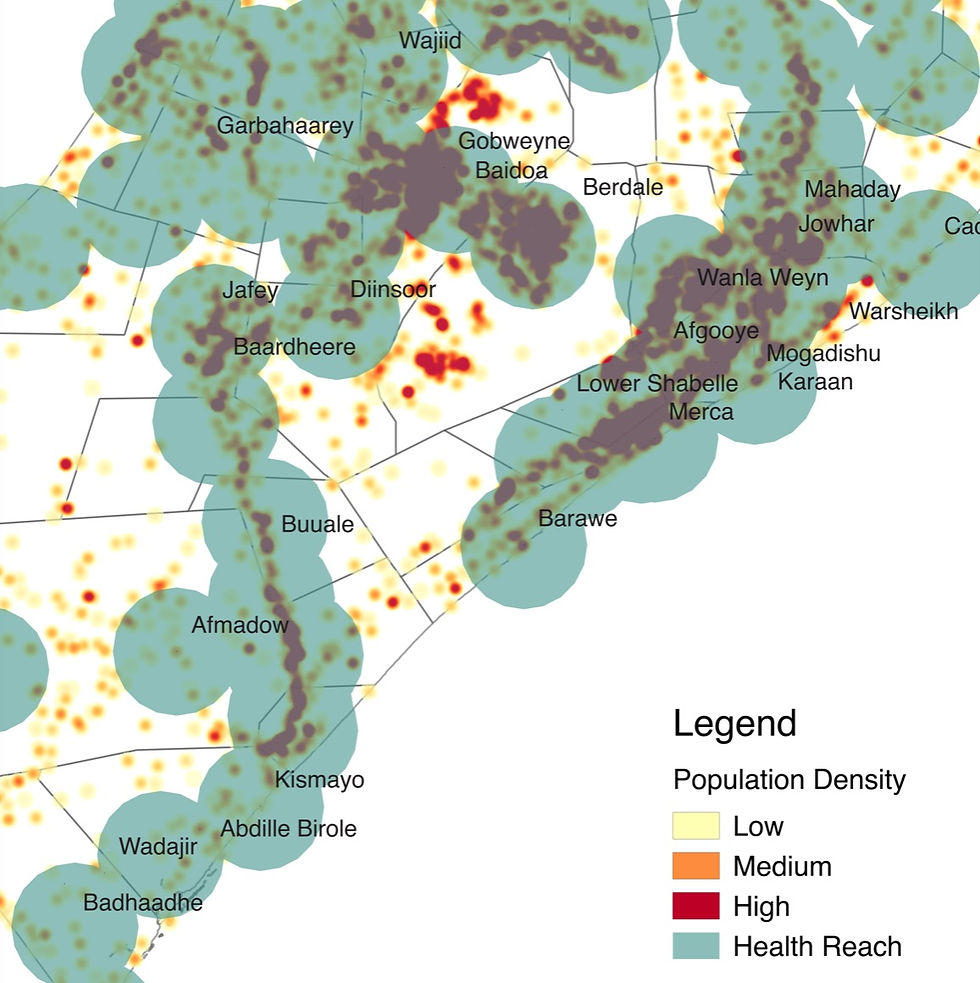
Several large-scale humanitarian and development projects are going on in Somalia where data is lacking, stressing the need to assess their impact using innovative technologies such as remote sensing and geospatial analysis.
Solution
Masae collected various sources of data, from VIIRS indicators to socio-economic survey results and applied advanced geospatial econometrics and impact evaluation techniques in order to precisely quantify the effect of infrastructure and development projects in the country.
In particular, using an iterative approach, Masae was able to estimate at which distance populations are no longer benefiting from the proximity of health services, education facilities and development project hotpsots.